Marae
Welcome to our Marae Profiles section.
A space to share matauranga relating to our beautiful marae within the Mahaanui Takiwā and well represented through the members of our Board.


Te Hapū o Ngāti Wheke (Rāpaki) Rūnanga
Centuries before Columbus voyaged to the Americas, Tamatea-Pokai-Whenua was exploring Aotearoa. On his trip back north from Murihiku, he stopped off in the hills above Rāpaki. But a southerly storm struck. His party’s fire sticks had gone out, so Tamatea recited the necessary karakia and called to his atua at Ruapehu, Tongariro and Ngaruahoe to send him fire. This they did – though some fell to the ground at Te Whakatakanga-o-te-ngaheru-o-te-ahi-o-Tamatea (Hanmer Springs), it eventually arrived and the evidence can still be seen today at Te Ahi a Tamatea. 1,000 years later Pākeha call that same hill Rāpaki Rock. Nearby, the distinctive cone-shaped hill which dominates Rāpaki is Te Poho o Tamatea.
Tamatea is usually associated with the first peoples in this rohe – Te Iwi Waitaha.
Ko Te Poho o Tamatea te Mauka
Ko Whakaraupō te Moana
Ko Te Rāpaki o Te Rakiwhakaputa te Marae
Ko Ngāti Wheke te Hapū
Ko Ngāi Tahu, Ngāti Mamoe me Waitaha hoki te iwi.
About the beginning of the 18th century, Te Rakiwhakaputa, a Ngāi Tahu rangatira toa of Kati Kuri descent, came up the harbour Whakaraupō – so named by Tamatea after the raupō which was then growing at the Head of the Harbour.
The Kati Kurī / Ngāi Tahu war party fought and defeated the resident manawhenua Ngāti Mamoe at Ōhinehou (now Lyttelton). That battle was marked by naming the hills above Ōhinehou, Ōkete-upoko, a name which was still used in 1849 with signing of the Port Cooper Deed when Ngāi Tahu sold most of the Whakaraupō catchment to the British Crown. Another major battle between Ngāi Tahu and Ngāti Mamoe was at Ōhinetahi, a pa site on the low ridge near the sea to the south of current Governor’s Bay.
The traditional story is that Te Rakiwhakaputa confirmed his take raupatu by casting his rāpaki (waist mat) on the beach and the kaika has ever since been known as Te Rāpaki o Te Rakiwhakaputa. He also more strategically ensured his descendants’ manawhenua rights to this takiwā by marrying Hine-te-a-Wheka with Ngāti Mamoe whakapapa.
Two hills at the head of Whakaraupō commemorate these Ngāi Tahu / Ngāti Mamoe contests. Ōrongomai (Cass Peak) marks the place where Ngāi Tahu heard (whakarongo) Ngāti Mamoe who were based at Mānuka Pā on the Huritini / Halswell River (present day Old Tai Tapu road). Ōmāwete (Coopers Knob) represents a rare recognition of the defeated enemy. Māwete was a Ngāti Mamoe rangatira from Mānuka Pā.
Once the main fighting in Whakaraupō was done Te Rakiwhakaputa moved on, but to ensure ahi kaa, he left his son Manuwhiri who built Te Pā Whakataka (near the current tennis courts in Governors Bay).
Another son Wheke settled at Rāpaki and the hapū there has become known as Ngāti Wheke and are manawhenua of the Whakaraupō takiwā. Wheke’s name is also marked by the hill above Cass Bay known as Te Moenga-a-Wheke – or The Great Tor. Wheke maintained a pā at Ōpāwaho near where the rail and road crosses the Ōpawa (ho) river. Ngāti Wheke regard the Ōpāwaho as the northern boundary of the hapū takiwā.
Between 1824 and 1828 Ngāi Tahu was afflicted by inter-hapū warfare. This included in 1826 the fall of Taununu’s specially designed pā for musket warfare at Rīpapa.
The first lease by Pākeha of land in Whakaraupō was in 1846 at Purau by the Greenwoods- shortly afterwards taken over by the Rhodes family. On 10 August 1949 the Whakaraupō/ Port Cooper Deed was signed by Walter Mantell and 18
Ngāi Tahu. For £200 the Crown received 65,000 acres and left Ngāti Wheke with 850 acres at Rāpaki as Native Reserve 875. A Census in 1857 listed 48 Ngāi Tahu living at Rāpaki, 12 in Taukahara and 12 in Purau. 50 years later only the Rāpaki kaika remained.
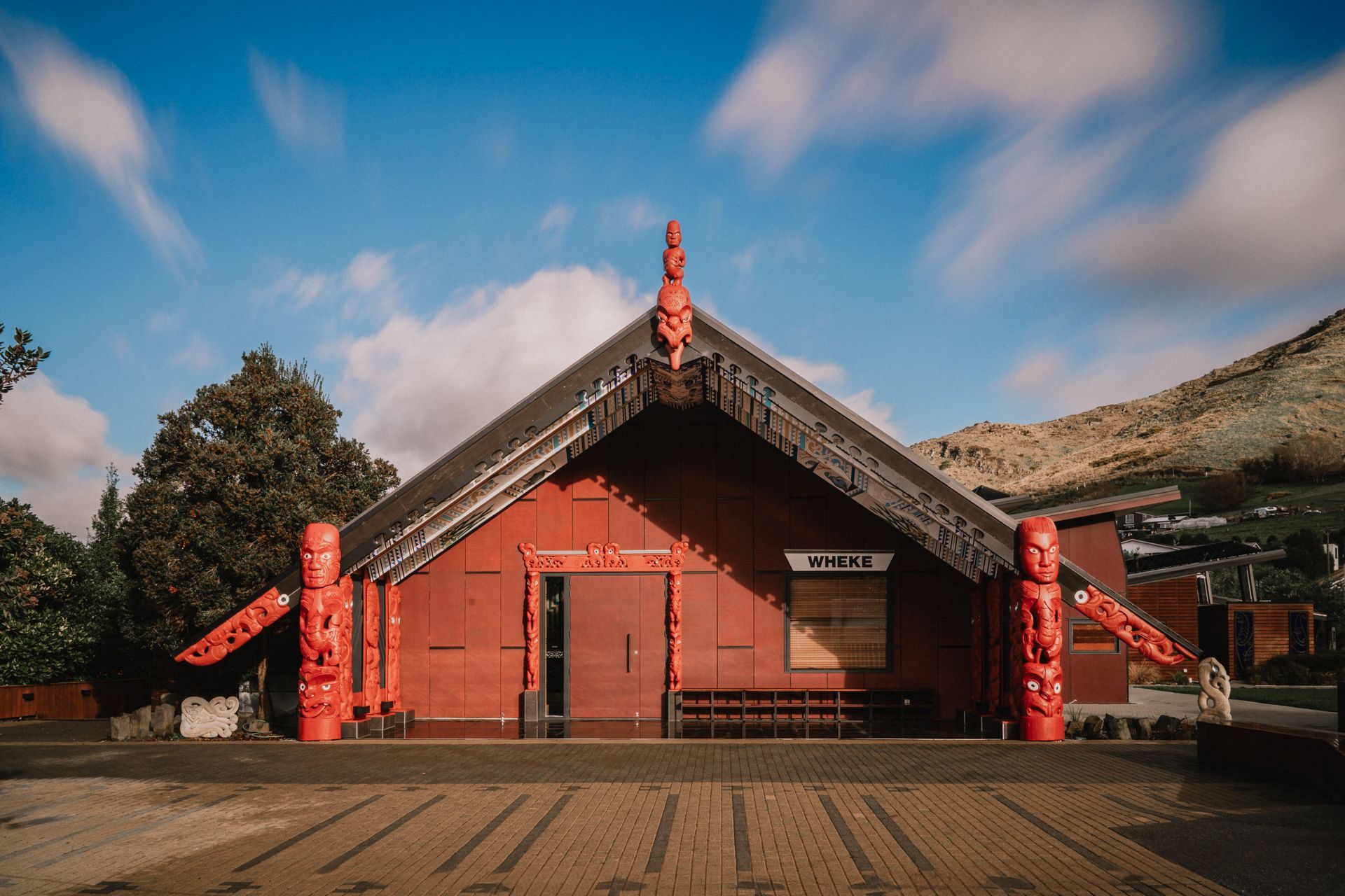
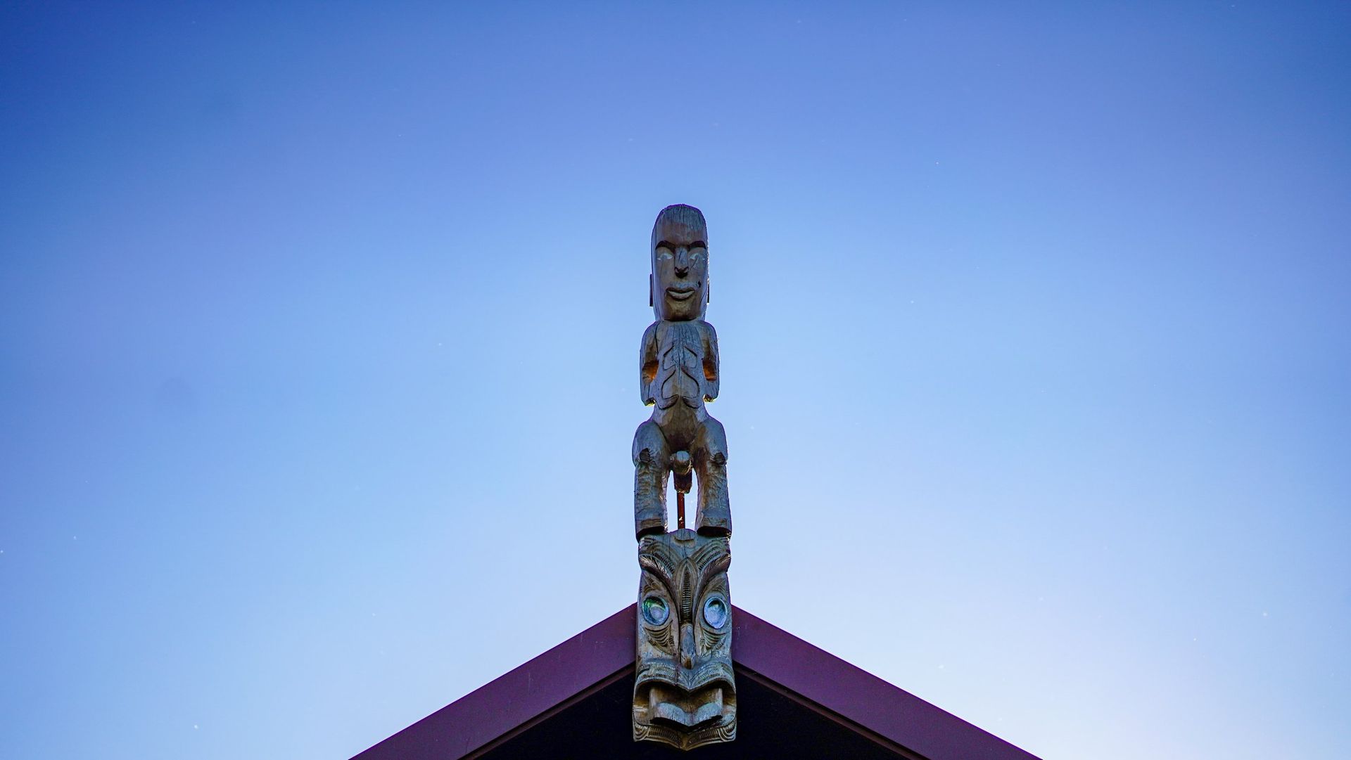
Community buildings built in Rāpaki were: 1869 the Māori Church; 1874 Catholic Church; 1878 Māori School, 1901 Rūnanga Hall and in 1916 jetty and war memorial ‘Gallipoli’. The school ceased functioning as a school in 1946. The buildings still exist except the Catholic Church which was demolished about 1950. The Hall was replaced with a new Whare Tipuna in 2011. This is a whare whakairo and the carvings, inside and out, represent the whakapapa of Rāpaki and the mana whenua who live there.
Te Hapū o Ngāti Wheke (Rāpaki)
Te Hapū o Ngāti Wheke (Rāpaki) is the modern day representative of the hapū Ngāti Wheke. The takiwā of the Rūnanga reflects the events and deeds of Te Rakiwhakaputa and his sons Manuwhiri and Wheke; events and deeds that secured their descendants’ manawhenua rights to the area. The takiwā centres on Rāpaki and the catchment of Whakaraupō and is described in the Port Cooper Deed of 1849 (English translation): (1)
“The inland boundary commences at the mouth of the Ōpawa thence along [the Halswell River] to Waihora; the outer boundary commences at Kaitara [Port Levy], thence by Te Pohue [Monument], thence by the Ahupatiki [Mt Herbert] ridge to Waihora following the line of the said mountain to Kuhakawariwari.”

Te Rūnanga o Koukourārata
Ka rere taku manu mai i tōna kōhaka ki Kaitara
Huri atu e taku manu ki Te Kūhakawariwari, tae atu ki Marokura
Ā, rere tonu e taku manu ki te Pae Mauka o Waipuna
Ka roha, ka tiu e taku manu ki te pā harakeke o Tutakakahikura ki Pōhatu
Koinei te whāriki tīpuna o Koukourārata whānui
Ko Tūtehuarewa tō mātou nei whare tīpuna
E tū mai ia i runga i te marae o Puāri, i raro nei o Manukuia, o Kakanui, o Te Upoko o Hinetewai, o Te Heru o Kahukura, o Te Ahu Pātiki hoki
Ko Koukourārata te awa e rere ana ki Te Ara Whānui a Makawhiua – tō moana
Ko Makawhiua te waka
Ko Kāi Tūhaitara te hapū e piri tonu nei ki te mana o te whenua…
Tīhei mauri ora!
Te Rūnanga o Koukourārata and Tūtehuarewa Marae
Koukourārata is an ancient place. It has a long history of Ngāi Tahu, Kāti Māmoe and Waitaha land use and occupancy and holds a significant place in tribal history and traditions. The settlement and marae are located on the ancient pā site Puari. The whare tipuna was built in 1923 and named Tūtehuarewa after an ancestor. In 2004 a whare kai was added to the marae buildings, and was named Te Pātaka o Huikai (The storehouse of Huikai) after the eponymous ancestor Huikai.
Te Rūnanga o Koukourarāta was created in 1996. The Rūnanga is the representative authority for the hapū Ngāti Huikai and Ngāi Tūhaitara, and the descendants of the original landowners of Koukourārata Māori Reserve 874. The Tutehuarewa Marae Committee and the Poti Riwhi Rūnanga precede Te Rūnanga o Koukourārata.
The pēpeha written above is the signature of Koukourārata. It is a mihi that sets out the whakapapa of Ngāti Huikai and identifies the landmarks that encompass the boundary points of the traditional takiwā.
Traditional kōrero
Te Rūnanga o Koukourarāta takes its name from the original kāinga located at the head of the bay, and more specifically the stream flowing there. The origins of the name come from Hataitai, Wellington – the main Ngāi Tahu settlement before crossing over to Te Waka o Aoraki (the South Island). The name recalls the actions of Rakaitekura and her husband Tumaro, also Te Aohikuraki. Tumaro had arrived home after a voyage to find his wife pregnant and was suspicious of an affair. He recited karakia and the names of other chiefs within the pā. When the name Te Aohikuraki was uttered, a baby boy was born. Tumaro then instructed his wife to go and wash, anoint, and dress herself at the sacred waters of nearby stream. These waters have been known as Koukourārata: Koukou = to anoint; Rarata = tame, quiet. The child was named Te Hikutawatawa o te Rangi; later to become Tūāhuriri.
Koukourārata is important as Horomaka Island was the first landing place of the celebrated waka taua Makawhiua and the Ngāi Tuhaitara war party Te Taua Tuawhiti. Ngāi Tuhaitara came to Te Pataka o Rākaihautu to seek utu upon the hapū of Tutekawa, but also to conquer new lands and re-establish family connections. Tutekawa had killed the two wives of Tūāhuriri in Hataitai (Wellington) and then fled south to
be with the people of Kāti Mamoe. Years later the children of Tūāhuriri along with other members of Ngāi Tuhaitara crossed Cook Strait and settled at Kahutara, south of Kaik- oura. Moki, one of Tūāhuriri’s sons, learned of the residence of Tutekawa at Waikakahi Pā on the shores of Te Waihora. This ignited old vengeance against Tutekawa and it was Moki that led the utu in honour of his father.
Moki organised the rangatira of Ngāi Tuhaitara and prepared the waka taua Makawhiua. Moki led the war party, and Maka captained the waka. Huikai, the ancestor of the tangata whenua of Koukourārata, was one of the chiefs that sailed with the Makawhiua.
The Makawhiua set sail from Kahutara to Kaiapoi and on to Te Pātaka o Rākaihautū. The waka made first landfall at what was to be named Horo-Maka and Koukourārata. A council of war was held on the banks of what is now Koukourārata. It was during this council that the mauri of Koukourārata was placed in the waters there.
The council decided to first attack Parakākāriki, a Ngāti Mamoe stronghold under the chief Te Aotutahi. Maka launched the waka Makawhiua from the island Horo-Maka (meaning ‘the dispersal of Maka) and the party made their way aroundthe eastern bays, landing at Paanau, Okaraka, Kaawatea, Otutahuao, Okaruru and finally Parakākāriki. These tauranga waka, or canoe landing sites, continue to hold great signifi- cance to Te Rūnanga o Koukourārata and associated hapū.
At Parakākāriki, the Kāti Mamoe rangatira Te Aotutahi and his son Uruhanga were slain. Te Aotutahi’s daughter Te Tawhera was taken by Huikai. The war party then returned to Koukourārata, and prepared to attack Tutekawa at Waikakahi Pā. With the Makawhiua anchored at Horo-Maka, the war party travelled overland from Koukourārata to Otutu to Te Upoko o Tahumataa to Waikakahi. There, Tutekawa was slain by Whakuku, and Waikakahi pā taken.
Huikai settled Koukourārata and married his Parakākāriki trophy Te Tawhera. The marriage of Huikai to Te Tawhera is important as this enforces Ngāti Huikai connections and claims to lands on Te Pataka o Rākaihautu.
Huikai and Te Tawhera had one son named Tautahi, and this son subsequently took sway of what is now central Christchurch on the banks on the awa Ōtakaro (Avon River). The Māori name of the city – Ōtautahi, means ‘the place of Tautahi’. This ancestral connection gives Te Rūnanga o Koukourārata customary interest in central Christchurch and the Ōtakaro.
The takiwā of Ngāti Huikai
The takiwā of Te Rūnanga o Koukourārata reflects traditional concepts of Māori land tenure, following the routes and events of the Makawhiua waka and Ngāi Tuhaitara war party, and enforced again in 1849 by Pukenui during the Port Levy Deed negotiations, when he declared the rights to Kaituna, Waihora and Waikakahi Pā.
The takiwā boundaries acknowledge the rangatira of Ngāti Huikai from Kaitara pā on the western side of Ki Te Ara Whānui a Makawhiua (the Ngāi Tahu name for Koukourārata harbour) along the ridgeline to the maunga Te Heru o Kahukura (ancient name for Te Pōhue, or the Monument) and Te Ahu Patiki, and over the Waipuna saddle through Kaituna Valley and along the shores of Te Waihora to Waikakahi, and then inland to the summit along the ridgeline to Pōhatu and along the northern coastline back to Koukourārata.
The modern day Te Rūnanga o Ngāi Tahu Act 1996 description of the takiwā is a shortened version of this, omitting the landmarks that encompass the true boundary points to the shores of Te Waihora.
The 1848 Port Levy Purchase
Ngāi Tuahaitara held undisputed mana whenua over Te Pātaka o Rākaihautū until 1849, when Walter Mantell negotiated the Port Levy Deed of Purchase on behalf of the Crown. Before any reservation was allocated or any price sought for land, the boundaries of the land to be sold had to be discussed and acknowledged.
Pukenui was the chief of Koukourārata at the time of the Port Levy Deed negotiations. After asserting the boundaries of the land in question, Pukenui and others demanded that Mantell provide 1000 pounds and three reserves: at Kaawatea, Pigeon Bay and Koukourārata. These demands were refused, and instead the hapū received 300 pounds and, despite promises that reserves would be ‘large and many’, only one reserve at Koukourārata was given. This meant that the whānau and hapū living throughout the tribal lands in the various bays and harbours had to leave their traditional homes and settle in Koukourārata. For
104 000 acres, Ngāi Tuhaitara/Ngāti Huikai received 1361 acres. This was to be shared among 59 owners (and did not include children).
The 1849 Port Levy Deed of Purchase and map (see map) identifies the traditional landmarks and land boundaries that today are the takiwā of Te Rūnanga o Koukourārata:
“…the inland boundary commences at Kaitara, thence to Te Pohue and along the ridge to Te Ahu Patiki, coming out at Waihora, it comes out at Waihora following the ridge of that mountain to Kuhakawariwari, that is to say by the outer boundary of Nohomutu and his people; the outer boundary commences at Waihora at Waikakahi thence it goes as is shown on the plan hereunto attached till it reaches the sea at Pohatu (Fly or Flea Bay)…”
Waiata
The following waiata was composed by Reri of Koukourārata, and sung at Koukourārata at around 1840, to a number of Ngāi Tahu chiefs returning from Sydney, including Tuhawaiki. The waiata was a challenge relating to manawhenua.
E koro mai Kaiapoi
Hurihuri mai te taringa
Ki te roko o te mokai
Kaore ia he mokai o Tawhiti
Ko Te Kawae hue a Mahaanui
Ko Rakawahakura
Ko ka kai kino a Marukore
Ko te Piki Turoa
Ko taku whare ko Karara Kopae
I whakapeti ai hoki
Koutou hakanunui
Ko taku puta ko Te Pakiaka
Ka rato ki a tatau tahi a pae nei
Whiti mai ki rawahi ki Arapaoa
Ko Whakamarama
Ko Te Pariwhakakatau
Ko Parakakariki ki Waikakahi
Ka korero te kutu ka hara tau ki te tini

Ōnuku Rūnanga
Ōnuku Rūnanga is the modern day representative of the hapū Ngāi Tarewa and Ngāti Irakēhu at Ōnuku, on the shores of Akaroa Harbour.
Ōnuku is home to generations of whānau. It is also of immense significance to Ngāi Tahu as an iwi. It was at Ōnuku on May 30, 1840 where the Treaty of Waitangi was first signed within the Ngāi Tahu takiwā (the first of three signings on Te Waipounamu). It is also where, in 1998, the Crown gave its apology for historical breaches of the Treaty in its dealings with Ngāi Tahu. The marae continues to be a place where Ngāi Tahu come together to kōrero important tribal issues. It is also used by the wider community for wānanga (learning gathering), birthday celebrations, weddings, conferences and retreats. The marae is known for its tranquil surroundings and the kai that is served to manuhiri.
Takiwā
The takiwā of Ōnuku Rūnanga is centred on Ōnuku and the hills and coasts of Akaroa Harbour to the adjoining takiwā of Te Rūnanga o Koukourārata and Wairewa Rūnanga.
Karaweko, a rangatira of the Ngāi Tarewa people of Ōnuku, set out the takiwā of Ōnuku as from the hill top of Pōhatu to the hilltop of Te Ruahine [point at the entrance of Akaroa Harbour] then to Timutimu Head on the west, but that the
roadways between the inner and outer bays should always be left open, so other hapū could come and go for mahinga kai and hui.
Ōnuku Marae
Ōnuku Marae is located on Māori Reserve 886, established in December 1856. The names of the original grantees on the deed of the reserve are Wiremu Harihona Karaweko, Hone Taupoki, Matene Paewiti, Rahera Tikao, Rawiri Te Ito, Wiremu Ngaere Te Ao, Hoani Kamokamo, Erihapete Kirihoto, Meri Harihona Karaweko, and Amiria Wi Puhirere. Ōnuku is one
of two reserves set aside in the deed of the Akaroa Block Purchase. The other is Ōpukutahi (Māori Reserve 883), located across the harbour at Wainui.
Our whare tūpuna is named Karaweko. Karaweko was a 14 year old warrior when Te Rauparaha attacked Ōnawe in
1832. He and his cousins were captured and taken to Kapiti as prisoners. However, Karaweko was treated more like a whānau member than a prisoner, and was allowed to return to Ōnuku 10 years later, where he took up his roll as the chief of Ōnuku. Wiremu Karaweko [also known as Big William] married Mere Whariu and had 5 children: Hira, Amiria, Hera, Kokone and Hoani. From this whānau descend the whānau that live at Ōnuku today.
The whare tūpuna was officially opened and blessed at a dawn ceremony on February 5th, 1997. It was the first carved house to be built on Banks Peninsula for over 100 years. The Ngāi Tahu paramount ariki Te Maiharanui is represented in the tekoteko of the meeting house.
Our wharekai is named Amiria Puhirere, the daughter of Karaweko and Mere Whariu. The wharekai was officially opened in 1990 during Centenary celebrations of the signing of Te Tiriti o Waitangi. Ōteauheke, the ancestral mountain of Ngāi Tawera, rises up behind Ōnuku Marae.
Takapūneke and Ōnawe
A number of sites in the Ōnuku Rūnanga takiwā are of significance to the history of Ngāi Tahu as an iwi, and to the history of New Zealand in the story of Te Tiriti. Two of these are Takapūneke and Ōnawe.
Takapūneke was the kāinga of the Ngāi Tahu ariki Te Maiharanui. Te Maiharanui was captured by Te Rauparaha in 1830, with the collusion of a British sea captain, John Stewart and his brig Elizabeth. Stewart had invited Te Maiharanui on board, where Te Ruaparaha’s war party was concealed. Te Maiharanui was killed, and the kāinga was destroyed. The survivors moved to the next bay south, known as Ōnuku (‘last resting place’). The massacre made Takapūneke a wāhi tapu, and to this day Ōnuku whānau prefer not to venture onto the land where the blood of so many of their ancestors was shed. The Elizabeth affair was the first step in the British annexation of New Zealand that would culminate in the signing of Te Tiriti o Waitangi.
Ōnawe is a peninsula at the head of the Harbour. A pā was built on the peninsula in 1830 under the charge of Takatahara, with two other chiefs – Puaka and Potahi, and became the site of a tragic incident in Ngāi Tahu history. In 1832, Te Rauparaha arrived in Akaroa Harbour with fifty waka and waited in the bays adjacent to Ōnawe with his prisoners from Kaiapoi. Knowing that he could not take the well fortified pā, he sent the Kaiapoi prisoners to tell Takatahara that they came in peace. When the gates opened, Te Rauparaha attacked, killing nearly 300 Ngāi Tahu and taking others prisoner. Karaweko was a one of the prisoners taken by Te Rauaparaha back to Kapiti.
Mahinga kai
Traditionally the whole the Akaroa Harbour was used for mahinga kai, however there are some specific places that Ngāi Tawera used regularly. One of these is the Ōnuku beach front. Whata were set up here to dry tuna and shark. There were cockle, pipi, and pakaka (crab) gathered from other areas of the harbour and eaten on the beach front. At Tikao Bay nets were put across the harbour to Red Point to catch shark, and these would be dried and shared with the whānau.
Wairewa Rūnanga
Kia ui mai rā
‘Kai hea te ahi hai tāmahana i taku tinana?’
Māhaku tēnei
E hoe tō waka i a Mahaanui, Kia ū rānō ki Whakaroa
Tauraka waka o Te Uruao
Me ahu atu koe ki te riu o te nawe o te iwi
Hikahika tākata, ko te haepapataka
Ka piki ki te tihi o Tuhiraki, Tērā Tūwhakarōria
Kā puna hauaitū, puna waimarie
Kā puna karikari a Rākaihautū
Hanatu ki Te Kaio, ki Marokura
Ka tū te kawa ki Waikākahi
Takahia atu te ara o Wharau iti, o Wharau nui
Hākai atu i kā ana i tāwenewene i te mata o Te Oka
Tērā te Ūpoko o Tahu Matā
Matatā i te mano o Irakehu i te hau kaitākata
Tirohia atu te rere a Hao
Mai i a Hikuika, a Puaha, a Ōpouwaho
Whāia te au ki te Hukahukatūroa
Ki Ōkana, ki Ōkuti, Tākiritāwai
Arā Wairewa, Pātaka Kai o Makō e
Tere tou a Hao mā te Mata Hāpuku
Ki kā wakawaka o kā kutu o Kaitōrete
Kapohia e te rika o Takaroa
Me whai atu i te auahi ki Ōhiriri
Kia tauwhirotia e te tāua ruruhau, Ko te Rōpūake
Kātahi nā te whitawhita o taku ahi e!
Whakaroko ake rā e aki, e kera
E noho mai koe i te kāika pepehatia
Māhau kā puka o te ahi o ō tīpuna e tahitahi kia whitawhita kia kite atu te muramura
O te hātete, o te kāpura i tawhiti
I ruka, i raro, i roto, i waho
Kia kiia ai ka toe nei
kā uri o Makō, o Irakehu ki te ao
He nui, he rahi, momona te ora e…
Ka hāhā te tuna ki te roto
Ka hāhā te reo ki te kāika
Ka hāhā te takata ki te whenua e
The above waiata was composed by Charisma Rangipunga for her tamariki to learn their Wairewataka, and encapsulates the takiwā and place names of Wairewa.This mōteatea was kindly gifted to the whānau of Wairewa. Wairewa Rūnanga is the modern day administrative council and representative of the hapū of Kāti Irakehu and Kāti Makō who hold manawhenua over the Wairewa takiwā. The takiwā of Wairewa Rūnanga as expressed in the Te Rūnanga o Ngāi Tahu (Declaration of Membership) Order 2001 centres on Wairewa and the catchment of our pātaka kai, Te Roto o Wairewa, and the hills and coast to the adjoining takiwā of Te Rūnanga o Koukourārata, Ōnuku Rūnanga and Taumutu Rūnanga. Sometimes these boundaries overlap and we share the responsibilities of Kaitiakitanga of Kaitōrete Spit, Te Waihora, Waikākahi, Ōnawe and Akaroa Harbour.
There are place names connected with Wairewa which evoke earlier histories. One example is the mountain which Wairewa Marae lies in the lee of, Te Ūpoko o Tahumatā. This name refers to the Ngāi Tahu ancestor Tahumatā who lived and fought in Hawkes Bay. It is also special as it is the mauka we use in our pepeha, which gives us our sense of place, our sense of belonging to the landscape, as outlined below.
Ko te Ūpoko o Tahumatā te mauka
Ko Ōkana te awa
Ko Wairewa te roto
Ko Uruao te waka
Ko Wairewa te marae
Ko Makō te whare tupuna
Ko Te Rōpūake te whare kai
Ko Kāti Irakehu, Kāti Makō kā hapū
Ko Waitaha, Kāti Māmoe, Kāi Tahu kā iwi
Makō is a great-grandson of Tanemoehau and Kurī (the eponymous ancestor of Kāti Kurī). His Whakapapa line traces from the mātāmua first born child of Tanemoehau and Kurī – Rākaitekura to his father Pūraho who is credited with leading the Kāti Kurī migration from Hātaitai to the Tory Channel in the South Island that became known as “Te-Wharauka-a- Pūraho-nui” (the big migration of Pūraho). With the death of his father Pūraho, the eldest brother of Makō, Marukaitātea (Maru) became the head of Kāti Kurī and it was under the leadership of Maru that Kāti Kurī eventually moved and settled in the Kaikōura area.
When Makō claimed the takiwā of Wairewa he did so at gathering of rakatira in Kahutara south of Kaikōura, under the mana of his older brother. This gathering was held so that the rakatira could hear first-hand the reports from Kaiapū and Tamakino who had escaped to return overland from a disastrous battle against Kāti Māmoe in Southland. Travelling under the cloak of darkness they came to their brother-in-laws house where they were given protection. The next morning they were greeted by the other chiefs to whom they recounted their travels. The two escapes were outlining the mahika kai they had seen on the way back. When it came to Ōhiriri, Ōtawiri and Wairewa, Makō asked the pair what food is available there. They replied “There are many kinds’ weka, kaka, kererū, pūtakitaki and tuna”. On hearing the bounty that was available at Wairewa Makō laid his tapatapa (claim) on the area. Shortly after an expedi- tion consisting of Kāti Kurī and Kāi Tūhaitara led by Moki left for Te Pātaka o Rākaihautū. When Makō arrived at Wairewa he laid his Waha Ika in the waters of the lake at Tākiritāwai and proclaimed:
“Ki uta he uruka mō tōku ūpoko, Ki tai he tūraka mō ōku waewae.”
Inland a pillow for my head and on the shores a rest for my feet.
This was a direct reference to the abundance of kai in the forests, lake and sea and by stating this Makō effectively claimed the takiwā for himself, his family and their descendants. The profusion of kai in Te Roto o Wairewa was renowned across Ngāi Tahu and in a modern context has been referred as one of the central food baskets of Ngāi Tahu in the Canterbury region with tuna, pātiki and inanga the main kai taken.
The produce of the lake was a source of mana and pride. It allowed the people to sustain themselves and their visitors. It also allowed food to be carried to other villages in kai- hau-kai, traditional food exchanges.This is also why our ancestors and their descendants stayed in this landscape, and occupied different pā and settlement sites including Ōtawiri, Te Mata Hāpuku, Ōruaka, Ngutu Piri, Marokura Nui, Waikākahi and Te Puia. Poutaiki and Ōtūngakau are two principal urupā associated with Te Roto o Wairewa.
This is also why our ancestors and their descendants stayed in this landscape, and occupied different pā and settlement sites including Ōtawiri, Te Mata Hāpuku, Ōruaka, Ngutu Piri, Marokura Nui, Waikākahi and Te Puia. Poutaiki and Ōtūngakau are two principal urupā associated with Te Roto o Wairewa.
Te Roto o Wairewa is one of only two customary lakes in New Zealand the other being Lake Horowhenua in the North Island. This was acknowledged under the Lake Forsyth Lands Vesting Act 1896, which stated:
“Nothing in this Act contained shall be deemed to prejudice or affect any Māori fishing rights which may be in existence at the time of the passing hereof with respect to any part of Lake Forsyth which may not be so reclaimed or drained.”
This is reconfirmed in the Fisheries (South-East Area Amateur Fishing) Regulations 1986, where it confirms that the tuna fishery at Te Roto o Wairewa is for Ngāi Tahu only. In December 2010 two Mātaitai were gazetted, the first being the Te Kaio Mātaitai from Te Kaio to Birdlings Flat, and the second being the Wairewa Mātaitai, which includes Te Roto o Wairewa and the Tākiritāwai River. The Mātaitai offer us a formal process to gain management of these important customary food gathering areas and resources.
Māori Reserves
Under the 1856 Akaroa Purchase the 440 acre Wairewa Māori Reserve 887 and the 432 acre Ōpukutahi Māori Reserve 885 was set aside for Kāti Irakehu and Kāti Makō. Wairewa Marae is situated on the Māori Reserve 887.
Whare Tupuna – Makō
Built on the footprint of our three previous Whare, this is the fourth to hold the name Makō and will continue to bea place of gathering for the people of Kāti Irakehu and Kāti Makō. During the mid-1800’s our Marae moved from the hill near the current Urupā to its present day location.
The first Whare, described as a “hall for Wairewa Māori named Makō”, was built and opened circa 1855 by R. Paurini on Wairewa Māori Reserve 887 Block 1V (4) Section 22. Thirty years later, on April 16th 1885, a “new Rūnanga hall” was opened by the Hon. H. K. Taiaroa on the same site. Following a fire 33 years later, the third Whare was built and opened in circa 1918 and remained in use until January 2008. The current whare was opened on the 1st November 2008 by Rev. Maurice Gray and Taua Naomi Bunker.
Whare Kai – Te Rōpūake
As was custom, the whare kai is named after the wife of Makō, Te Rōpūake. Te Rōpūake was the eldest daughter of Te Rakiwhakaputa (her father’s first cousin). It is most likely the marriage was to cement relations between the families, and keep the Kāti Kurī lines strong on Te Pātaka o Rākaihautū. The current whare kai was built in 1991 by the whānau of Wairewa.

Te Taumutu Rūnanga
Ngāi Te Ruahikihiki ki Taumutu
Following the wreckage of Te Waka o Aoraki (the canoe of Aoraki) that became the South Island, Rakinui (Sky Father) sent a number of his mokopuna from the heavens to transform the waka into land that would sustain human life. Among these demi-gods were Tūterakihaunoa whose job was to carve the keel of the upturned waka into mountains and valleys, Kahukura who forested the bare landscape and filled it with animals, and Marokura who carved bays, inlets and estuaries and populated them with fish of many varieties. The mana of Tūterakihaunoa remains to this day given his ongoing residence as the Atua Tiaki (a supreme guardian) for Te Waihora. His resting place at Whakamātakiuru (Fishermans Point) gives the mana to the people of Taumutu as the tangata tiaki for this area.
The first people to arrive in the central Canterbury area were those on the Uruao waka under the captaincy of Te Rakihouia. Te Rakihouia had been instructed by his father Rākaihautū to seek out the rich resources of the coastal area (ki tai) while he traversed the mountain regions identifying the resources of land (ki uta). Te Rakihouia discovered the wetland of Te Waihora that teemed with fish and birds and upon reuniting with his father took him to the lake where Rākaihautū proclaimed Te Waihora as Te Kete Ika a Rākaihautū – The Great Fish Basket of Rākaihautū. Te Rakihouia equally named the coastline of this area as Kā Poupou a Te Rakihouia.
Some generations later a Ngāti Māmoe/Ngāi Tahu chief named Tutekawa, who had been embroiled in skirmishes with his chiefly relations in the North Island, came to live at Ōhōkana near Kaiapoi. After a time Tutekawa heard that the eels of Te Waihora were of a better quality so he moved to the shores of the lake and built the pā of Waikākahi. His son Te Rakitāmau meanwhile built his pā at Taumutu which he named Hakitai. Surrounded by his allies, and at a distance from his enemies, Tutekawa felt quite safe. After many years though his hapū were growing anxious with the rapid southward advance of Ngāi Tahu. They urged the old chief to escape while the opportunity remained but his only reply was “What will then become of the basket of flat fish spread open here?”
Tutekawa was killed when the Ngāi Tahu forces arrived at Waikākahi, and the various chiefs of Ngāi Tahu set out to secure land for themselves. Prior to their arrival on Banks Peninsula a young chief Te Ruahikihiki had received reports about the abundance of inaka, pātiki and tuna in Te Waihora and proclaimed “Tāku kāika ko Orariki” (Orariki at Taumutu is my place), thus placing a tapatapa (claim) on it. Once
at Banks Peninsula though, Te Ruahikihiki claimed several places with his first landing at Wainui (Akaroa) where he commenced to dig fern root and cook it. He then passed around the coast leaving his stepson Manaia at Whakamoa, other relatives at Waikākahi, and finally took up his permanent residency at the pā of Orariki, Taumutu.
The ahi kā of Ngāi Te Ruahikihiki remains at Taumutu to this day, and together with the residence of Tūterakihaunoa at Whakamātakiuru, instils the primary responsibility of kaitiaki for Te Waihora. However, in this role our hapū recognises the surrounding hapū of Te Pātaka o Rākaihautū and Kaiapoi whose rights extend to the lakeshores.
Ngāti Moki Marae
Ngāti Moki Marae is located at Taumutu, on the quiet shores of Te Waihora at the southern end of Kaitorete Spit. The background roar of the ocean is ever present as waves break onto this narrow spit that separates Te Waihora from the sea.
Taumutu means the end of a ridge, or a high ridge. The name may also be a shortened version of Te Pā o Te Ikamutu – a traditional site in the area. The swampy environs of Te Waihora including Waiwhio (Irwell River), Waitātari (Harts Creek) and Waikekewai provided the prime environment for tuna (eels), pātiki (flounder), kanakana (lamprey) and waterfowl such as pūtakitaki (paradise duck). This bounty provided for those living at Taumutu but also afforded them a ready currency for bartering with other hapū all over the South Island.
The lake as a mahinga kai (food source) has always been a defining aspect of marae life at Taumutu. The following whakatauki encapsulates the significance and abundance of these food resources:
Ko ngā hau ki ētahi wāhi
Ko ngā kai kei Orariki
No matter which way the wind blows (season), one can always procure food at Taumutu
Despite the decreasing population at Taumutu during the late 1800’s, a new meeting hall was built and officially opened on 7 May 1891. It replaced an earlier structure that had stood on the same site. The hall was named Moki after the tipuna whose original historic pā had stood on the same ground.
Moki has undergone extensive modernisation and additions over the years and so bears little resemblance to its original 1891 form. Since the 1980’s there has been a gradual resurgence in the Ngāi Tahu population at Taumutu, with the marae being frequented for monthly Rūnanga meetings, as well as wānanga, whānau events, school visits and other hui. More people are becoming actively involved in the marae that is a favoured spot for wānanga and educational hui.
Te Taumutu Rūnanga has invested much time and energy in restoration of the riparian margins of the two streams that meet up at, and run past, Ngāti Moki Marae into Te Waihora. A bridge has been constructed and a walkway is planned to link the two old pā sites and provide easy access from the marae to the church and urupā. This work has resulted in the return of many native plant species and it is hoped that the rejuvenation of native bird, fish and insect species will follow.
Ongoing concerns about the preservation of and respect for these resources are central to the work of Te Taumutu Rūnanga today.
Historic Pā Sites
The pā of three heroic Ngāi Tahu tūpuna – Te Rakitāmau,
Te Ruahikihiki and Moki II – were established at various times at Taumutu. Te Rakitāmau’s pā Hakitai was situated near the traditional opening of Te Waihora to the sea. This pā site has now been reclaimed by the sea. Orariki (the place of chiefs), the pā of Te Ruahikihiki, and Te Pā o Te Ikamutu (the village of the backwash of the fish) were built on a narrow section of land between the edge of Te Waihora and the sea where the Hone Wetere Church now stands.
These pā together with Te Pā o Moki (the pā of Te Ruahikihiki’s son Moki) were built on strategic and defensible sites that were once surrounded by swampland. Earthwork remains associated with these pā are still visible at Taumutu today. The present day Ngāti Moki marae is built on the site of Te Pā o Moki.
The Taumutu Kāinga
A place of occupation for over 600 years, Taumutu has a longstanding cultural history and has been the site of much archaeological interest for this reason. Borrow pits are visible in the paddock across from the marae. These large depressions in the ground are the result of the removal of earth for use in what are considered to be some of the southernmost kūmara gardens in the South Island.
The 19th century saw the kāinga at Taumutu embroiled in the turmoil of the Kai Huaka feud from 1825-28. The kāinga was then doubly threatened by Te Rauparaha’s invasion of the south and the arrival of increasing numbers of European farmers and fishermen.
European immigrants worked to harness the bounty of the lake and develop its surrounding lands into pasture.
Ngāi Tahu influence in the area was rapidly eroded culminating in the 1848 Kemp Purchase that saw much of the land at Taumutu passing out of Ngāi Tahu control. Despite Ngāi Tahu reserving Te Waihora from sale, exploitation of the lake and its resources continued and the European presence led to the population at Taumutu being in serious decline by the end of the 19th century.
Takiwā of Te Taumutu Rūnanga
The takiwā of Ngāi Te Ruahikihiki centres on Te Waihora and extends west across central Canterbury to Kā Tiritiri o Te Moana (The Southern Alps). Travelling south from Taumutu you encounter Muriwai (Coopers Lagoon), another important mahinga kai site – renowned for a special variety of eel that were provided to manuhiri (guests). Further south are the ancient kāinga at the river mouth of the Rakaia River. These sites contain evidence of some of the earliest wharenui and wharekai structures in the country, but are threatened by current day hut settlements and coastal erosion. Travelling further down the coast is Hakatere (Ashburton River) and the boundary between the Taumutu and Arowhenua people.
Turning inland, the wāhi taonga of Hinepaaka is situated near Alford. This site was the name of a sole majestic matai tree that stood as a marker and symbol for those travelling across the Plains and was named after the grandmother of Te Ruahikihiki. Although the original tree was felled by wind many years ago, a new tree was planted in its place by the kaumātua of Taumutu, Arowhenua and Tuahiwi.
Entering the mountains, place names associated with Te Ruahikihiki, Te Rakitāmau and their descendants can be found. Several of these occur in the Waitāwhiri (Wilberforce River) associated with the pounamu trails through to Te Tai Poutini.
Returning to the foothills, visible from Te Pā o Moki, sites such as Tūtepiriraki (son of Tutekawa and brother of Te Rakitāmau) and Nuku Mania – a maunga cited by the people of Taumutu, can be located adjacent to where the Waimakariri river emerges from the gorge.
Returning to Te Waihora, the numerous waipuna (springs) are important sites for mahinga kai and other tikanga (practises). Of particular note is Te Waiwhakaheketūpapaku – a spring head water burial site in which many significant tupuna are buried. Te Kuaowhiti, Waitatari, Waiwhio, Te Raki and Tūtakahikura are all important sites along the western lake edge. Waikirikiri, with its many pā tuna (eel weirs) and Ararira are two of the larger freshwater inflows to the lake. Huritini, Taitapu, Ahuriri and Motukarara provide important mahinga kai and wāhi taonga. To the far eastern end of the lake, at Kaituna, the Waikakahi Pā of Tutekawa is situated. Tutekawa, together with his son’s pā Hakitai at Taumutu held the mana over Te Waihora until the arrival of Ngāi Tahu forces.
Between Waikakahi and Hakitai, lays Kaitorete with its many hundreds of umu and mahinga kai sites. Te Puna o Pohau indicates a junction between Wairewa and Taumutu. Travelling on toward Taumutu the habitation site of Kaikanohi can be located, before reaching Te Arariro – the lake opening site where Te Waihora is periodically opened to the sea.