IMP: Ngā Take ā-hikawai Me Ngā Kaupapa | Catchments

6.1 Hurunui

Wāhi Tuaono | Part 6

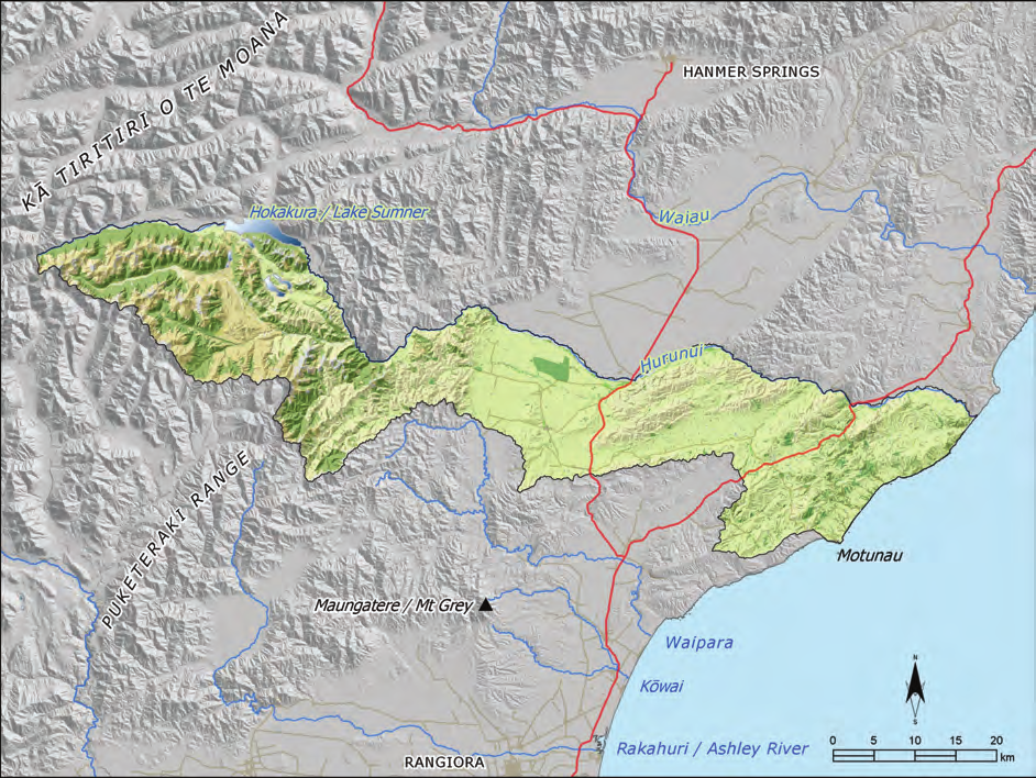
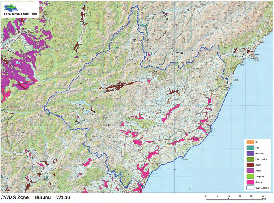
This section addresses issues of particular significance in the Hurunui River catchment (Map 6). The Hurunui is the northern boundary of the region covered by this IMP, and an area of shared interest with Ngāti Kuri (Te Rūnanga o Kaikōura).

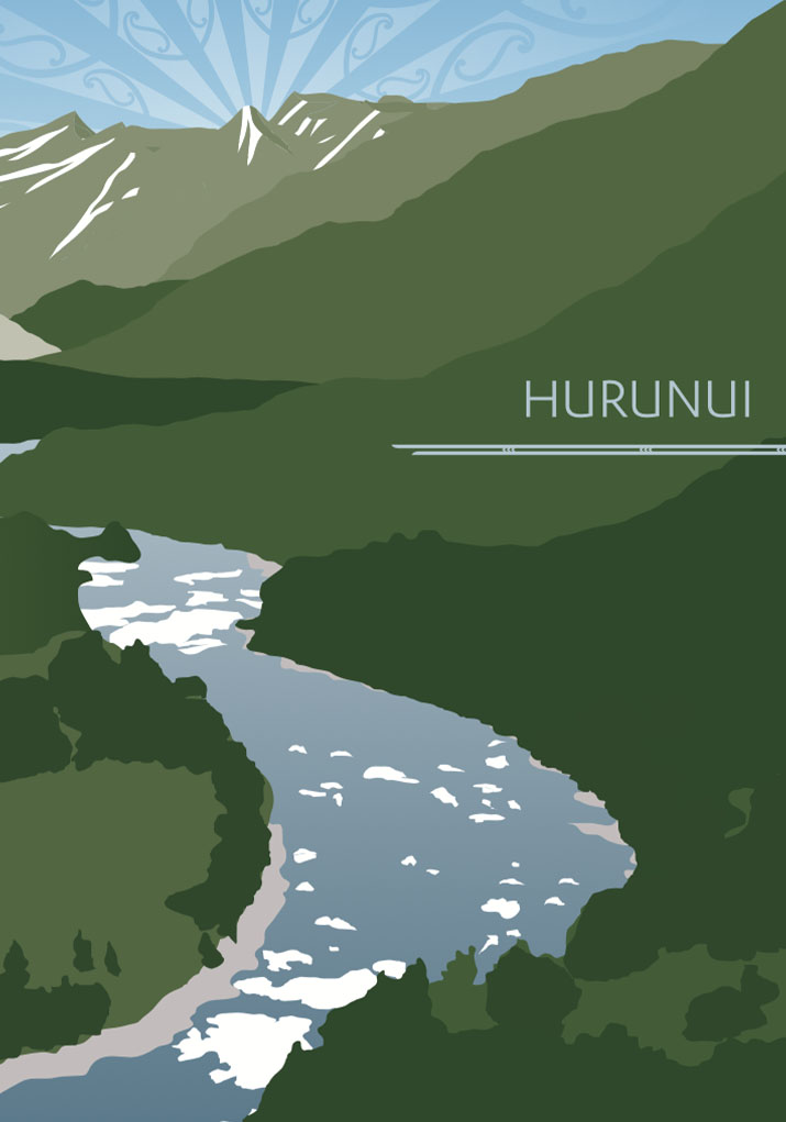
Throughout its course from the mountains to the sea, the Hurunui River exhibits a diversity of character, reflected in the different landscapes through which the river flows. From the mountainous headwaters and high country lakes, the river flows through steep and highly scenic gorges to become a braided river flowing through the plains to emerge at an extensive lagoon and coastal forest. For Ngāi Tahu, the variable character of the river is essential to its cultural value, and is reflective of its life force.

The relationship of Ngāi Tahu with the Hurunui River catchment is centuries old and of outstanding significance to the iwi. The river possesses a range of characteristics that are considered to be outstanding for spiritual, cultural and environmental reasons, including natural character, ara tawhito, mahinga kai and wāhi tapu. These values are a fundamental aspect of the relationship of Ngāi Tahu to the Hurunui River, and their protection is the focus of the issues and policy in this section.

Statutory Acknowledgements for the Hurunui River and Hoka Kura/Lake Sumner reflect the high cultural value of water in this catchment. Schedule 20 and 21 of the NTCSA 1998 set out Ngāi Tahu associations with the Hurunui River and Hoka Kura, and acknowledge the immense cultural, spiritual, historical and traditional significance of these water bodies (see Appendix 7).

Map 6: Hurunui catchment showing only the area covered by this IMP

NOTE: See Section 5.1 (Issue K1 - Recognising Manawhenua) for guidance on identifying the Papatipu Rūnanga with manawhenua and kaitiaki interests in this area.

Ngā Paetae | Objectives

(1) The Hurunui River is recognised as an area of shared interest with Te Rūnanga o Kaikōura.
(2) The outstanding cultural characteristics and values of the Hurunui River catchment are protected and restored, mō tātou, ā, mō kā uri ā muri ake nei. Land use in the catchment reflects land capability and water limits, boundaries and availability.
(4) Groundwater and surface water quality in the catchments is restored to a level suitable to provide a safe, reliable and untreated drinking water supply and enable cultural, customary and recreational use.
(5) The Hurunui River Mouth and Hoka Kura/Lake Sumner and its associated wetlands are recognised and provided for as distinctive cultural landscapes within the catchment.
(6) Mahinga kai species and sites, and the traditions associated with them, are protected and enhanced.

Ngā Take | Issues of Significance

H1: Shared Interest

Issue H1: The Hurunui river catchment is an area of shared interest.

Ngā Kaupapa / Policy

H1.1 To recognise and provide for the Hurunui River catchment as an area of shared interest with Te Rūnanga o Kaikōura.

He Kupu Whakamāhukihuki / Explanation

The Hurunui River is the northern boundary of the region covered by this IMP. The catchment is an area of shared interest with Te Rūnanga o Kaikōura, as per the takiwā boundaries set out in the Te Rūnanga o Ngāi Tahu (Declaration of Membership) Order 2001.

H2: Outstanding Values

Issue H2: The Hurunui river catchment has a number of outstanding characteristics and values.

Ngā Kaupapa / Policy

H2.1 To require that the whole of the Hurunui catchment is recognised as possessing the following outstanding cultural characteristics and values, and that these key characteristics are protected as a first order of priority:
(a) Mahinga kai;
(b) Natural character;
(c) Wāhi tapu and wāhi taonga;
(d) Hoka Kura;
(e) River mouth environment; and
(f) Ara tawhito ki pounamu.

H2.2 To require that the outstanding cultural characteristics of the Hurunui river catchment are protected by:
(a) Asking ourselves ‘what we can do for the river, not what the river can do for us’; (2)
(b) Protecting the uninterrupted flow of water Ki Uta Ki Tai, source to sea;
(c) Avoiding any activity that will result in the modification of Hoka Kura;
(d) Avoiding any dams, diversions or storage on the mainstem (including all braids) of the river;
(e) Avoiding any dams, diversions or storage on the South Branch;
(f) Protecting the hāpua / river mouth environment;
(g) Protecting and enhancing mahinga kai species and habitat; and
(h) Actively sustaining our own mahinga kai traditions associated with the river, including intergenerational knowledge transfer.

He Kupu Whakamāhukihuki / Explanation

The Hurunui River possesses a range of outstanding characteristics or values that are considered to be outstanding for spiritual, cultural and environmental reasons. The cultural significance of the river is heightened by the fact that it remains one of the few braided rivers in the Ngāi Tahu takiwā that has not been significantly modified and/or degraded.

"The Hurunui River, its tributaries and lakes are one of the last relatively untouched waterways in our takiwā… the significance of the Hurunui River and its associated waterways today lies in the fact that this ecosystem has yet to be substantially altered by intensive water abstractions and the inevitable associated land use practices.

...the simple fact that the Hurunui River has yet to be exploited by land use practices that have degraded the mauri of our rivers elsewhere means that this traditionally significant mahinga kai environment continues to be of outstanding significance to our culture today."
(3)

The South Branch of the Hurunui is considered a wāhi taonga in its own right, due to its role in flushing and cleansing sediment from the river, and for its wetlands.(4) The South Branch also supplies the sediment load needed by the river to scour periphyton. This wāhi taonga status is one of the main justifications for tāngata whenua opposing any damming or diversions of the South Branch.

The Hurunui River as an outstanding cultural landscape

The Hurunui River possesses a range of characteristics that are considered to be outstanding for spiritual, cultural and environmental reasons. These characteristics were identified and discussed at length in Ngāi Tahu submissions and evidence in response to an application for a Water Conservation Order on the Hurunui River and Lake Sumner (Hoka Kura) by the NZ and North Canterbury Fish and Game Councils and the NZ Recre- ational Canoeing Association (2009). They include:

Natural character: The Hurunui River is one of the few braided rivers in the Ngāi Tahu takiwā that is not significantly modified and/or degraded. The upper catchment has a high degree of natural character. The diversity of character of the river is also a significant natural characteristic. The hāpua at the mouth of the river is an outstanding landscape due to its unusual character and high biodiversity and habitat values.

Ara Tawhito ki Pounamu: The Hurunui –Taramakau trail is one of the most important traditional pounamu trails for Ngāi Tahu, providing the easiest and safest route between Kaiapoi and Te Tai Poutini. Nohoanga were located at points along the length of the river to facilitate the gathering and working of mahinga kai resources.

Mahinga kai: The mahinga kai values of the catchment were particularly important to Ngāi Tahu parties travelling to the Te Tai Poutini. Traditionally the river was known for tuna and īnanga. Raupō from the margins of the upper catchment lakes was used for making mokihi. The dried leaves of tī kouka, known as pahau, were used along with harakeke and mountain grasses to weave paraerae (sandals) for travellers, and the kauru, or pith of the tree was a food source. Harakeke was used to make clothing, baskets, nets, mokihi, and rope ladders. The NTCSA 1998 also recognises two Nohoanga in the catchment (Hoka Kura and the Hurunui River mouth), acknowledging the importance of the river as mahinga kai.

Cultural heritage values: Wāhi tapu and wāhi taonga values exist along the length of the river. The Hurunui River mouth is particularly rich in terms of archaeological evidence, as a moa hunter site occupied 700 years ago. Hoka Kura/Lake Sumner, the Waitohi River, and the gorges above the Mandamus confluence (including Māori gully) are also areas of particular significance for their wāhi tapu status.

Cross reference:


» General policies in Section 5.3 – Issue WM5: Statutory Acknowledgements, and Issue WM9: regional water infrastructure

» General policies in Section 5.8 – Issue CL1: Cultural landscapes, and Issue CL3: Wāhi tapu me wāhi taonga

H3: Pressure on the River

Issue H3: There is increasing pressure on the river and associated cultural values as a result of:
(a) Water storage, hydrogeneration and irrigation proposals; and
(b) Land use conversion.

Ngā Kaupapa / Policy

H3.1 To critically evaluate the cultural implications of any water storage proposal for the Hurunui River catchment to enable hydroelectric generation or community irrigation scheme and land use intensification, with particular regard to:
(a) Potential effects (positive and adverse) on outstanding characteristics associated with the river as per Policy H2.1 (a) to (f) above.
(b) Potential environmental and cultural effects (positive and adverse) as per general policy on Regional water Infrastructure (Section 5.3, Issue WM9).

H3.2 Land use intensification must be managed to ensure that the only effects on water quality in the catchment are improvements.

H3.3 To require a precautionary approach to land use conversion and intensification in the catchment, consistent with general policy on the Effects of rural land use on water (Section 5.3 Issue WM7) and Intensive rural land use (Section 5.4 Issue P2).

H3.4 To support the concept of ‘creating headroom’ through improved nutrient management to enable land use change or intensification, but only when:
(a) Water quality load limits reflect the need to improve water quality and general cultural health of the catchment, particularly lower catchments, and not just maintain the existing state; and
(b) Improving water quality and the cultural health of rivers is given priority over enabling development; and
(c) Headroom is not created using nutrient trading.

He Kupu Whakamāhukihuki / Explanation

Policies H3.1 to H3.4 are intended to ensure that development pressures are assessed and managed in a manner consistent with protecting the characteristics of the Hurunui River catchment that are considered to be of outstanding significance (Issue H2). These characteristics are at risk due to increasing pressure on the land and water resources of the catchment, including regional infrastructure proposals for irrigation and hydroelectricity generation.

Tāngata whenua seek to protect a continuous and reliable flow of water through the river Ki Uta Ki Tai. The undisturbed passage of water from source to sea is not only necessary to sustain the wairua and the mauri of the river, but also to enable fish migration and to allow for the natural occurrence of freshes and floods and the movement of sediment down the river and out into the coastal environment.

Nutrient management is a significant issue in the Hurunui catchment, given the high levels of land use intensification. Nutrient levels in the catchment are at limit, but there is a continuing demand to make more land available for intensive land use.

Cross reference:

» General policy on the effects of rural land use on freshwater resources (Section 5.3 Issue WM7)

H4: Effects of land Use on the Lower Catchment Areas

Issue H4: Cumulative effects of land use on the lower catchment and associated cultural values, in particular:
(a) Water quality and quantity;
(b) Riparian areas and wetlands;
(c) Soil health; and
(d) The river mouth environment (see Issue H.5).

Ngā Kaupapa / Policy

H4.1 To protect the flows of the Hurunui River and tributaries Ki Uta Ki Tai by ensuring environmental flow regimes established for the Hurunui and its tributaries deliver meaningful cultural and environmental outcomes, as per general policy on Water quantity (Section 5.3 Issue WM8), with particular attention to:
(a) Protecting the outstanding cultural characteristics of the catchment; and
(b) The relationship between surface water and groundwater, and therefore the relationship between river health and aquifer recharge.

H4.2 To require immediate measures to improve water quality in the lower catchment as per the measures and mechanisms in general policies on Water quality (Section 5.3 Issue WM6), with particular focus on:
(a) Prohibiting any activity that will result in the further decline of water quality in the lower catchment (e.g. discharge permits that enabling a discharge into water);
(b) Requiring the protection and restoration of wetlands as filters and flood barriers;
(c) Requiring improvements to the quality and quantity of run off entering waterways; and
(d) Requiring the establishment of riparian areas as buffer zones.

Monitoring

H4.3 To continue to undertake Cultural Health Assessments in lower catchment areas to assess the cultural health of waterways and assess progress towards meeting water quality and general cultural health objectives.

H4.4 To continue to advocate for more effective monitoring of the cumulative effects of land use on the lower catchment, and for stronger action for non-compliance.

H4.5 To require monitoring of water quality of the hāpua / river mouth environment as a measure of overall catchment health of the effects of land use on the health of the river.

Priorities

H4.6 To restore wetlands as a general priority in the catchment.

H4.7 To identify and initiate protection, enhancement and restoration activities for the following sites, species and ecosystems as a matter of priority:
(a) Wetlands throughout the catchment, including remnant wetlands in the lower Waitohi River alongside State Highway 7 to its confluence with the Hurunui;
(b) Lower catchment from the Mandamus River down (improving water quality); and
(c) Pahau River (reducing nutrient loads).

He Kupu Whakamāhukihuki / Explanation

The relationship between land use and water quality and quantity is an important kaupapa for tāngata whenua, as a regional issue and at a catchment scale (see Section 5.3 Issue WM7).

Water quality declines significantly in the lower reaches of the Hurunui River. This is a reflection of changes in land use patterns, vegetation clearance, wetland loss, and agricultural land use in areas such as the Amuri Plains, and the resultant effects of point source discharges such as drainage of intensively stocked land and irrigation bywash in rivers. There has been an approximate 98.7% loss in wetland area in the Hurunui Waiau Zone over time (Map 7)(5). Riparian areas are degraded or absent in much of the lower catchment due to poor land management, weed invasion, and stock access, and therefore waterways have little or no buffers as protection from sedimentation and nutrient run off.

The Hurunui catchment continues to experience pressure for land conversion (Issue H3), including the conversion of forestry blocks to more intensive land use such as dairy. Land use intensification must be carefully and prudently managed to ensure that there is no further decline in water quality and soil health, and proposed land use activities must show how they can improve and restore land and water resources. This requires recognising and working within the natural limits of both land and water resources.

"For both of these species [whitebait and eels], access to the sea is important – for eels, it is essential. If water abstractions are allowed to intensify on the Hurunui River, then the risk of the narrow river mouth closing is greatly increased. There is no science behind this statement, just common sense and a realization that this is exactly what has occurred to other rivers in our takiwā (c.f. Waipara River)." (6)

The health of hāpua reflects the health of the catchment, and therefore how well we are doing managing water and land resources (Section 5.6, Issue TAN3), as the outcomes of all land and water use find their way to the hāpua. Establishing water quality and cultural health monitoring at the Hurunui river mouth is a priority for tāngata whenua, as part of a continuing cultural health assessment and monitoring program for the catchment (see Box - Cultural Health Assessments in the Hurunui catchment).

Map 7: Historical wetlands in the Hurunui Waiau Zone (Te Rūnanga Ngāi Tahu)

Cultural Health Assessments in the Hurunui Catchment

Ngāi Tahu conducted cultural health assessments in the Hurunui catchment in 2011. Sixteen sites were assessed, including the hāpua, key tributaries, the Lake Sumner/ Hoka Kura outlet, the two nohoanga sites, and several key wāhi taonga.

The sites were assessed using the following criteria: catchment land use, surrounding vegetation, riverbed conditions, evidence of modification, water quality, presence, abundance and health of mahinga kai species, prevailing pressures (e.g. pest and weeds) and actions required to improve the health of the site.

The highest scoring site was the Lake Sumner/Hoka Kura outlet. The site received the highest score to date (2011) of State of the Takiwā cultural health assessments in the Ngāi Tahu takiwā.

The poorest scoring site was downstream of the Waikari wastewater outlet. The majority of concerns on poorly rated sites related to:

  • Habitats dominated by invasive flora (e.g. willows & weeds);
  • Widespread absence of planted / fenced riparian margins; and
  • Potential for increased degradation to water quality if existing land use practices continue or intensify through the provision of more water to the region.

Source: Lenihan, TM. 2011. Presentation to the Hurunui Zone Committee. May 12, 2011.

Cross reference:

» General Policies in Section 5.3 – Issue WM6: Water quality; Issue WM7: Effects of rural land use on freshwater resources; and Issue WM8: Water quantity

H5: Hurunui River Mouth

Issue H5: Protection of the Hurunui River mouth as a cultural landscape.

Ngā Kaupapa / Policy

H5.1 To recognise, provide for and manage the Hurunui River mouth environment as a cultural landscape with significant cultural, ecological, historical, traditional, and contemporary associations, in particular:
(a) Protecting sites of significance and cultural associations to place;
(b) Ensuring continuous and reliable flow of water to the river mouth;
(c) Maintaining the saltwater-freshwater balance in the hāpua, and therefore mahinga kai habitat; and
(d) Ensuring fish passage between the river and the sea.

H5.2 To require monitoring of water quality of the hāpua / river mouth environment as a measure of overall catchment health of the effects of land use on the health of the river.

He Kupu Whakamāhukihuki / Explanation

The Hurunui River catchment possesses a range of characteristics that are considered to be outstanding for spiritual, cultural and environmental reasons (Issue H2), and a number of these characteristics are associated with the river mouth. The Hurunui River mouth is of immense significance to Ngāi Tahu, culturally and ecologically. Culturally, the site is rich in wāhi tapu and wāhi taonga values, as a major Moa-Hunter Occupation site. Ecologically, the hāpua provides a freshwater sea water interface that is critical to mahinga kai habitat. A continuous flow of good clean water Ki Uta Ki Tai is critical to protecting the river mouth environment and the cultural values associated with it.

Cross reference:

»  Issue H2: Protecting outstanding cultural characteristics of the river

»  General policy on hāpua (Section 5.6 Issue TAN3)

»  General Policies in Section 5.8 – Issue CL1: Culturallandscapes; and Issue CL3: Wāhi tapu me wāhi taonga

H6: Weed Control

Issue H6: Woody trees and weeds such as willow, gorse and broom are invading the beds and margins of the Hurunui and its tributaries.

Ngā Kaupapa / Policy

H6.1 To work with Environment Canterbury and the Department of Conservation to identify all parts of the Hurunui River and its tributaries where the active riverbed is invaded by standing trees and woody and herbaceous weeds, and develop a control strategy.

H6.2 To promote the adoption of a long-term plan in the takiwā to phase out willows and re-establish with appropriate native species.

H6.3 Environmental flow and allocation limits must ensure that there is sufficient water in the river, and that the duration of frequency of floods is such, that weedy species do not establish or spread in the river bed

He Kupu Whakamāhukihuki / Explanation

As with many braided rivers in the takiwā, trees such as willow, and woody weeds such as gorse and broom, have invaded the riverbed in the lower reaches of the Hurunui. The invasion of weedy species in the bed and margins of the river is attributed in part to the lack of sufficient and regular flood flows to enable the river to cleanse itself. When river ecosystems are compromised, weedy species are more likely to establish. A critical component of any long term strategy to control weeds in riverbeds and margins is the establishment of appropriate native riparian species along river margins as weedy species are removed.

Cross reference:


» General policy on weed control in and along riverbedsand margins (Section 5.3, Issue WM15)

H7: High Country Lakes

Issue H7: The protection of high country lakes and associated cultural values in the Hurunui catchment.

Ngā Kaupapa / Policy

H7.1 To recognise and provide for Hoka Kura and associated high country lakes, waterways and wetlands as a cultural landscape with significant historical, traditional, cultural and contemporary associations. Key characteristics of this cultural landscape include:
(a) High natural character;
(b) Tribal history;
(c) Mahinga kai species and habitat, including species that are no longer found elsewhere in the catchment; and
(d) Statutory Acknowledgement and nōhoanga.

H7.2 To protect high country lakes and their margins from sedimentation caused by inappropriate land use by:
(a) Prohibiting stock access; and
(b) Prohibiting forestry activity on lake margins.

He Kupu Whakamāhukihuki / Explanation

Hoka Kura is referred to in the tradition of “Ngā Puna Wai Karikari o Rākaihautū”, which tells of how the principal lakes of Te Waipounamu were dug by the rangatira Rākaihautū using his famous kō or digging stick. Schedule 20 of the NTCSA 1998 sets out Ngāi Tahu associations with Hoka Kura, and acknowledges the immense cultural, spiritual, historical and traditional significance of this high country lake (see Appendix 7). The Act also recognises a Nohoanga associated with Hoka Kura, acknowledging the importance of the lake as mahinga kai.

In addition to Hoka Kura, a number of other lakes exist in the upper catchment: Waitetemoroiti (Loch Katrine) and Lakes Marion, Taylor, Sheppard and Mason, and the smaller Lake Mary and Raupō Lagoon (tarns). Lakes such as Little Lake Mason are highly valued as habitat for native fish and invertebrates. Risks to these lakes include sedimentation and damage to lake margin vegetation as a result of stock access.

"Once safely over Noti Taramakau (Harpers Pass) travellers replenished their food supplies from the resources of Hoka Kura (Lake Sumner) and Waitetemoroiti (Loch Katrine). It was a time for resting and food gathering for the next stage of their journey.

…eels and ducks were gathered from Hoka Kura (Lake Sumner), Waitetemoroiti (Loch Katrine), Lakes Taylor and Sheppard and the Waitohi River; weka and pukeko from the Waikari Plain; and eels and ducks from the Waipara River.

In 1993 when I last visited Hoka Kura (Lake Sumner) I observed that the eel weir post at the eastern end of Hoka Kura (Lake Sumner) where it flows into Waitetemoroiti (Loch Katrine) was still visible." (7)

Cross reference:

» General policy on Statutory Acknowledgements (Section 5.3, Issue WM5)

END NOTES / REFERENCES

  1. Crengle, H. with Te Rūnanga o Kaikoura, Te Rūnanga o Tūāhuriri and Te Rūnanga o Ngāi Tahu, 2002. Hurunui River Tangata Whenua Values Report, p. 31.

  2. Solomon, R., 2009. Statement of Evidence on behalf of Te Rūnanga o Ngāi Tahu, Ngāi Tūāhuriri and Te Rūnanga o Kaikoura, for an application for a WCO on the Hurunui River and Lake Sumner (Hoka Kura).

  3. Lenihan, TM., 2009. Statement of Evidence on behalf of Te Rūnanga o Ngāi Tahu, Ngāi Tūāhuriri and Te Rūnanga o Kaikoura, for an application for a WCO on the Hurunui River and Lake Sumner (Hoka Kura).

  4. Crengle, H. with Te Rūnanga o Kaikoura, Te Rūnanga o Tūāhuriri and Te Rūnanga o Ngāi Tahu, 2002. Hurunui River Tangata Whenua Values Report.

  5. Hurunui Waiau Zone Implementation Programme (ZIP). 2011.

  6. Lenihan, TM., 2009. Statement of Evidence on behalf of Te Rūnanga o Ngāi Tahu, Ngāi Tūāhuriri and Te Rūnanga o Kaikoura, for an application for a WCO on the Hurunui River and Lake Sumner (Hoka Kura).

  7. Russell, J.M., 2009. Statement of Evidence on behalf of Te Rūnanga o Ngāi Tahu, Ngāi Tūāhuriri and Te Rūnanga o Kaikoura, for an application for a WCO on the Hurunui River and Lake Sumner (Hoka Kura), paragraphs 13-15.